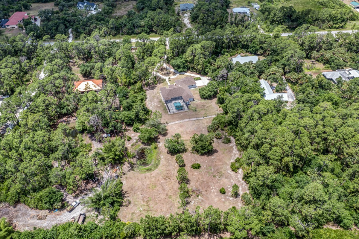
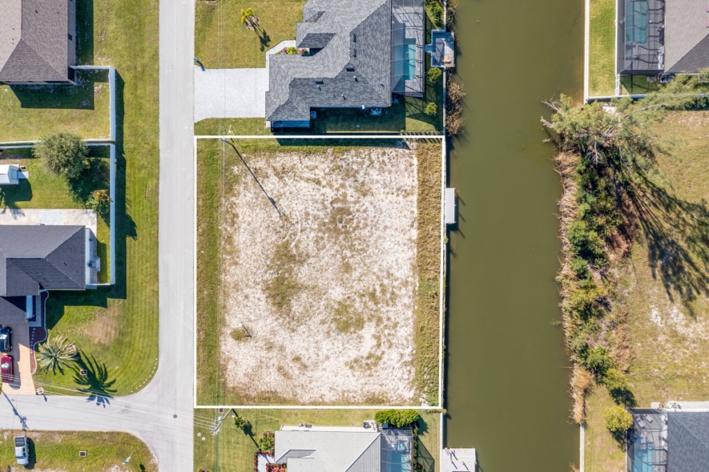
Vacant Lot From A Birdseye View
Unlocking Your Vacant Lot’s Potential with Aerial Photography
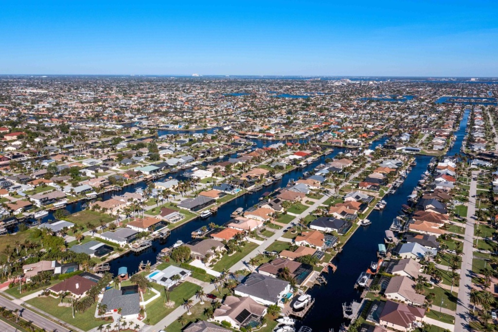
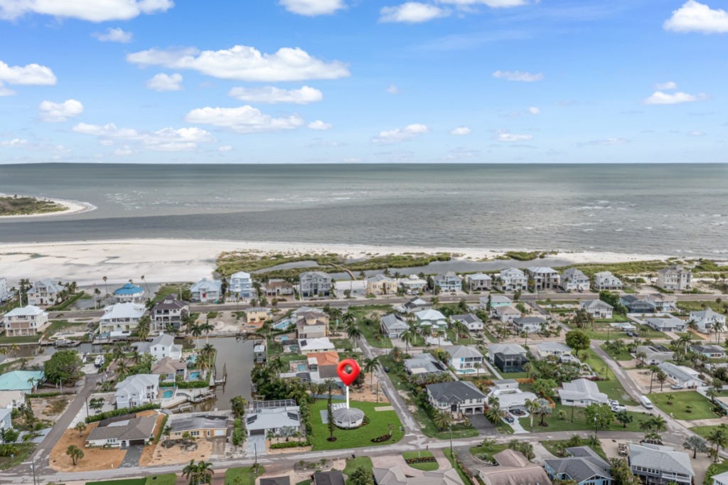
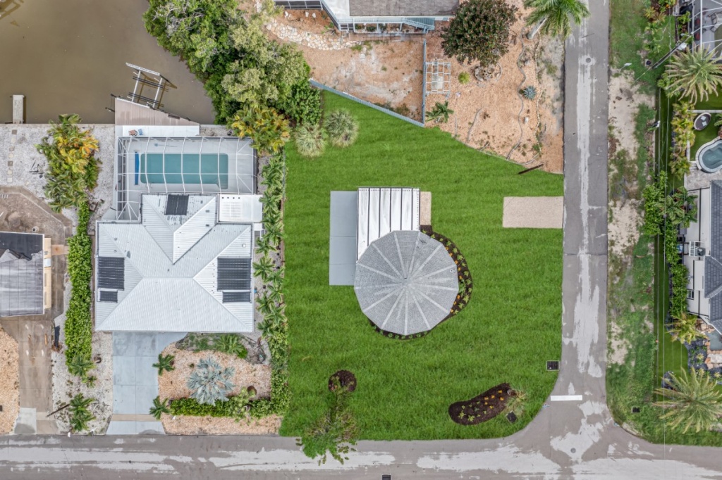
Imagine soaring above your vacant lot, witnessing its true form and potential unfold before your eyes. This is the power of aerial photography, a perspective that ground-level images simply cannot capture. Drone technology allows us to capture breathtaking bird’s-eye views, revealing hidden contours and the true extent of your property.
More than just pretty pictures, these aerial images provide invaluable insights for planning and development.
- Unveiling Hidden Potential: From a bird’s-eye view, you can clearly see the lot’s overall shape, size, and any unique features like slopes, water bodies, or even hidden access points. This panoramic perspective helps you visualize the possibilities and identify the best ways to utilize the space.
- Identifying Ideal Building Sites: If you’re planning to build, aerial photography helps pinpoint the most suitable locations for your structure. You can identify areas with optimal sun exposure, and proximity to utilities. This minimizes potential construction challenges and ensures a smoother building process.
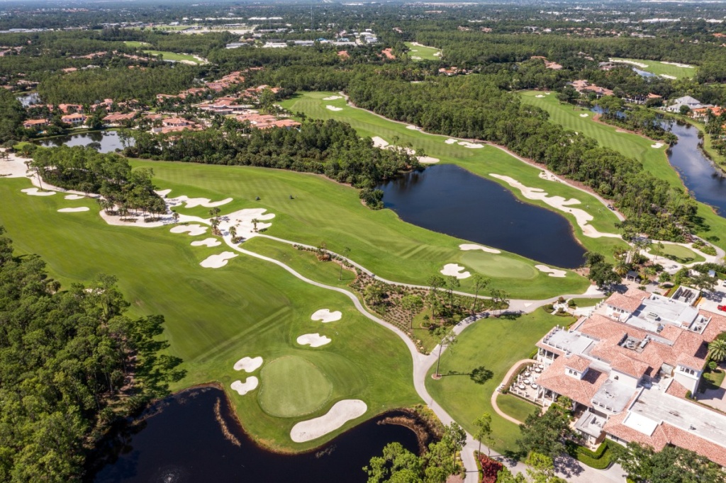
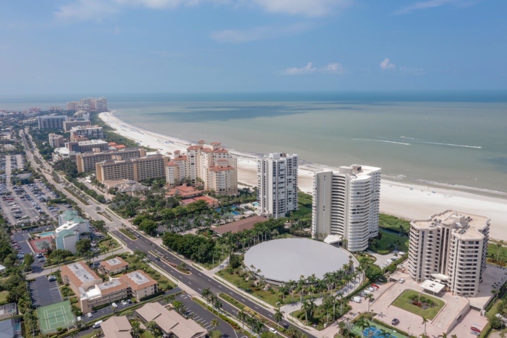
- Enhanced Project Visualization: Aerial photography can be used to locate surrounding amenities such as shopping centers, road routes, canals and other important landmarks.
At Realty Media 360 we understand the importance of capturing the true essence of your land. Our experienced FAA certified drone pilot will deliver high-resolution aerial photographs that showcase your property’s unique character and potential.
Ready to experience the power of aerial photography? Contact us today or schedule service online.
From A Birdseye View Things Starts To Look Different
Drone photos offer a unique and captivating perspective of a property, showcasing its size, layout, and surrounding environment. 1 This can make your listing stand out and attract more potential buyers
Drone photos can create a more professional and polished presentation of your listing, leaving a positive impression on potential buyers
Studies have shown that properties with drone photos tend to sell faster and for a higher price compared to those without. This is because they generate more interest and attract a wider pool of potential buyers.
Boost the Potential of Your Vacant Lot with Aerial Real Estate Photography by Realty Media 360
Your vacant land can get you the required attention of buyers with our Aerial Real Estate Photography at Realty Media 360! We offer drone photography for real estate that ensures high-quality images, giving viewers a birds-eye view of your vacant property, giving a clear idea about the features, layout, and surrounding environment.
We showcase Your Vacant property in a New Light!
Unfolding all the details of your vacant property using drone technology as a part of Aerial Real Estate Photography reveals all the features of your property that are not visible with the photos taken from the ground. This helps you sell your property faster and plan for future development if you intend to develop it further with some purpose in mind!
The Advantages of Aerial Real Estate Photography
It Makes it easier to Showcase Your Land’s potential
Aerial Real Estate Photography takes photos of your vacant land from the top, which defines the land’s size, shape, and topography to the viewer with ease. The viewer can see and analyze the possible building area, which is great for developers, investors, and real estate agents interested in your property.
Building Sites
Looking at your vacant land from ground level, especially when it is large, may not give you an idea of the potential areas where future structures can be built. But through our drone photography of your land, you can identify lucrative areas with excellent sunlight accessibility and fewer challenges for building structures in the future.
Know the surrounding areas
The photography captured by drones at Realty Media 360 helps the property viewers learn all the details of the land and surrounding areas. It gives them an insight into the amenities and utilities around them, such as shopping malls, roadways, landmarks, etc. We are happy to share that our drones are operated by FAA-certified drone pilots skilled in capturing photos that make your land look tremendous and attractive.
Explore the Vacant Lot Aerial Photography Packages With Us!
Book our Aerial Real Estate Photography today to showcase your land in the best possible way!